
[ad_1]

By Claudia Smith, Regional Business Development Manager, Globalstar.
In 2021, the world was on the receiving end of 432 natural disasters that affected more than 100 million people and caused over $250 billion in economic losses. But when the floods recede, the fires go out and storms blow away, what do we tend to do? Rebuild. Tell ourselves a thousand-year-storm won’t come again – even though there are five times more disasters in an average year today than there were 50 years ago, as climate change increasingly dominates our weather.
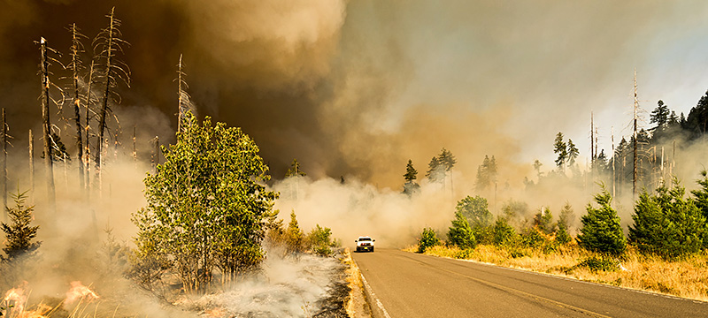
Where There’s Smoke, There’s Fire
There has to be a better way – and IoT technology is helping deliver it. To monitor the potential of forests to burn, one tech company integrates a satellite data module into weather stations positioned through the forest lands its customers manage. The stations collect near-real-time data on drought stress, snowpack change and fire danger without costly site visits, and the data is transmitted across a low-Earth orbit satellite network into a cloud-based management platform.
When fires do break out, knowing the location of firefighting vehicles and crews is critical. Solar-powered satellite asset trackers, feeding GPS coordinates to digital mapping systems, let fire managers in the US Forest Service make the most efficient use of every vehicle in their fleet. Wildfires are highly unpredictable and only precise information on crew location can keep firefighters safe.
Emergency managers spend their time imagining the worst that can happen and trying to prepare for it. Satellite IoT is making the job easier by the year.

Keeping It Simple
When the disaster arrives, it is often too late for technology to make a difference. That puts a premium on preparedness: equipping people and vehicles with asset trackers and worst-case communication devices. Disasters also have a way of wiping out the ground-based communications on which we usually depend, from wireline data and voice to mobile service. Satellite-based systems need to be part of every disaster preparedness plan – and they need to be extremely easy to use. First responders can’t train on all the technology they need to use and have no time to figure it out in the midst of emergency response.
GPS Messengers are simple devices with a dual purpose: to report where the user is and to let users send messages to check in, report conditions or signal for help using a basic keypad. Weyerhauser, Canada’s largest forest products company, uses satellite devices to connect with remote work crews. The technology gives workers a reliable, secure way to connect to help when they need it, without keeping a fleet of helicopters in the air checking on their situation.
Matching Supply and Demand
Responding to disasters is as much a matter of logistics as compassion. When disasters force people from their homes, the Federal Emergency Management Agency supplies trailers as temporary housing. But there are only so many trailers to go around, and a trailer in the wrong place is as good as worthless. To match demand and supply, FEMA maps data generated by asset trackers on each trailer, so that its limited supply can stretch as far as possible.
Asset trackers like these can do much more. When agencies deploy trucks to ferry responders and deliver supplies, IoT goes with them. Onboard sensors automatically monitor runtime of engines, oil pressure, fuel levels, start-and-stop motion and position, and trackers/transmitters aggregate the data and transmit it securely to management systems. This data not only helps protect drivers, it allows maintenance to be scheduled before breakdowns occur in the field.
Understanding the Cause
Satellite asset trackers also play a role in researching the climate change that drives the steady increase in natural disaster. A major university studied the speed and elevation changes of a glacier in southeast Alaska. Glaciers can suddenly change speed due to meltwater or sediment accumulating at the base as the climate warms. During these short-lived surges, glaciers can move at many times their normal rate. To accurately track the phenomenon, the university team mounted satellite trackers on poles driven into the glacier next to scientific instruments. The trackers transmitted precise GPS coordinates to the team, which made equipment maintenance in the harsh weather safer and more efficient, because the location data allowed researchers to find them regardless of the glacier’s movement. The reporting also confirmed that equipment was still recording data and had not fallen into crevasses or been buried in snow.
Another research program tracks the movements of icebergs in the Arctic Ocean to provide data to the World Climate Research Program. A satellite device proved to be the answer. Its compact design and long battery life made it practical to deploy via drone onto icebergs, where they reported GPS coordinates once per hour via satellite. Their low cost also made it practical to replenish them regularly when an iceberg’s rolling motion dumped them into the sea.
Emergency managers have a tough job compared with most of us. They spend their time imagining the worst that can happen and trying to prepare people, infrastructure, systems and logistics for it. The good news for them is that satellite IoT is making the job easier by the year.
[ad_2]
Image and article originally from iotbusinessnews.com. Read the original article here.